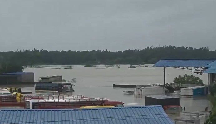

Bhubaneswar: Odisha remained in the grip of an intense monsoon spell on Tuesday as a deep depression over northern part of the state continued to trigger widespread heavy rainfall, raising the threat of flooding in several districts. With rivers swelling rapidly and low-lying areas inundated, the state government has stepped up preparedness, deploying disaster response teams and placing district administrations on high alert.
According to the India Meteorological Department (IMD), the deep depression over north coastal Odisha and adjoining Gangetic West Bengal moved west-northwestwards at a speed of around 12 kmph during the past six hours. The weather system was centred near Baripada and is expected to continue moving across north Odisha, south Jharkhand and north Chhattisgarh over the next 24 hours.
Under its influence, the IMD has forecast widespread rainfall with isolated heavy to extremely heavy showers across Odisha over the next few days. The weather office has issued Red and Orange warnings for several districts, urging authorities and residents to remain vigilant.
As a precautionary measure, all government and private schools remained closed on Tuesday in Balasore, Bhadrak, Mayurbhanj, Keonjhar and Sambalpur districts.
The incessant rainfall has pushed several rivers towards danger levels, significantly increasing flood risks. The Water Resources Department has warned of a major flood in the Baitarani River by Tuesday evening, while flooding is also expected in the Salandi and Jalaka rivers as water levels continue to rise.
The Jalaka River crossed the danger mark at Mathani in Balasore district on Tuesday morning. Officials said the danger level at the gauge station is 6.50 metres, while the river was flowing at 6.51 metres, raising fears of flooding in downstream villages. Heavy rainfall in the upper catchment areas of Mayurbhanj district has further aggravated the situation.
Balasore district witnessed the heaviest rainfall in the state during the past 24 hours. Balasore town recorded an extraordinary 246.6 mm of rainfall, while Nilagiri received 239 mm, Jaleswar 236.8 mm, Remuna 222 mm, Govindpur 213.8 mm and Rajghat 202 mm. In neighbouring Mayurbhanj district, Betanati recorded 202 mm of rainfall and Balimundali received 174.2 mm.
Keonjhar district was also severely affected after incessant rainfall since Monday evening triggered flood-like conditions, particularly in Telkoi block. Around five feet of water reportedly flowed over the bridge across the Samakoi River, completely cutting off road connectivity between the Telkoi block headquarters and nearly ten gram panchayats.
The overflowing river also snapped road links connecting Telkoi with Dhenkanal, Angul and Cuttack, leaving hundreds of vehicles stranded on both sides of the submerged bridge.
ALSO READ: Odisha reviews disaster preparedness ahead of deep depression landfall
State Revenue and Disaster Management Minister Suresh Pujari said the government was closely monitoring the evolving situation. He said flooding during the monsoon was not new for Odisha and that district administrations, ODRAF, Fire Services and other emergency response agencies had been kept ready to respond to any eventuality.
The minister said heavy rainfall had been recorded in several districts, including Sundargarh, Sambalpur, Jharsuguda, Bargarh, Balasore, Bhadrak, Jajpur, Keonjhar, Mayurbhanj, Dhenkanal, Angul, Deogarh, Boudh, Sonepur, Nuapada and Bolangir, while rainfall activity had also continued in south Odisha.
Authorities have advised people living in low-lying and riverbank areas to remain alert as the deep depression continues to move inland. Officials said the situation is being monitored round the clock, with rescue and relief teams on standby in vulnerable districts.